Community map
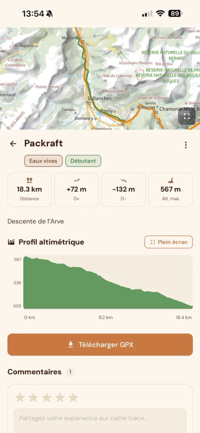
GPX lines shared by the community (whitewater), filterable by skill level and region.
AvailablePackslope brings packrafters, canyoners, and kayakers around a living community map — GPX lines, live Vigicrues river levels, and field reports.


Packrafting, canyoning, and kayaking are serious pursuits—water conditions can change everything. A canyon runnable at 50 m³/s can be dangerous at 80. A river in flood turns a descent into a trap.
Whether you’re running a pool-drop canyon, packrafting, or kayaking, the question is always the same: What’s the flow today? Who ran it recently? What did the river look like?
Packslope started from a simple idea: the best beta for a run isn’t in a guidebook—it’s in the head of whoever did it last week. Our mission is to make that shared knowledge easy to access—in real time, with official Vigicrues data in the same tool you plan with.
Tools built for whitewater sports, by people who paddle. Packraft, canyoning, and kayak.
GPX lines shared by the community (whitewater), filterable by skill level and region.
AvailableRiver levels and flows on the map, refreshed every 15 minutes from the official API.
AvailableNotifications when stations you follow change level or alert status—straight from official data.
PremiumImport tracks from Garmin, Strava, or your GPX files. Unlimited, even on the free plan.
Free · UnlimitedExport community lines for offline use on your GPS or favourite app.
PremiumReport strainers, drops, closed access, flood zones. The community confirms reports in real time.
AvailableOfficial flows and gauges on the map without leaving the app. Per-station history so you can see the trend before you go.
Every line tells a story. Add photos, leave feedback, rate the run. Collective knowledge becomes a living planning tool.
Free to explore. €9.99 once to unlock everything.
Everything you need to discover the community and plan trips.
One payment, every feature, forever.
One-time purchase—no subscription, no renewal.
Available on iOS. Android coming soon.